
Page-2 of Earthquake
NASA plans to monitor volcanoes from space
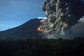
NASA is in plans to monitor volcanoes, earthquakes and other land deformation events from space using InSAR. InSAR InSAR or Interferometric Synthetic Aperture Radar is a remote sensing technique that uses SAR (synthetic aperture radar) images to monitor natural hazards ..
Earthquake near the Kuril Islands
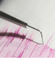
A 7.5 magnitude earthquake struck near the Kuril Islands in the Pacific Ocean, prompting warnings of hazardous tsunami waves in the adjoining areas. About the Earthquake The earthquake was of the magnitude 7.5 and it originated at a depth of ..
7.5 magnitude Earth Quake hits Russia; 0.3m high Tsunami Waves expected

On March 25, 2020, 7.5 magnitude earthquake hit northern Pacific. The quake was 37 miles deep and stuck the eastern Kuril Islands of Russia. Highlights The Pacific Tsunami Warning Centre has warned hazardous Tsunami waves n the coasts of the ..
Month: Current Affairs - March, 2020
Disaster Management Exercise of BIMSTEC NDRF begins in Bhubaneswar
The National Disaster Response Force of Government of India is to host the second BIMSTEC Disaster Management Exercise-2020 (BIMSTEC DMEx-2020). The exercise is to be held in Bhubaneswar, Odisha between February 11, 2020 and February 13, 2020. The main objective ..
Month: Current Affairs - February, 2020
GoI launches “Seismic Hazard Microzonation” to minimize earthquake disasters
The Ministry of Earth Science has launched Seismic Hazard Microzonation project in major cities of India. The project aims to reduce hazards of seismic activities by putting in adequate measures What is Seismic Hazard Microzonation? It is the process of ..
Month: Current Affairs - January, 2020
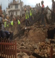
Philippines hit by a major earthquake
An earthquake of magnitude 6.1 had struck the northwest part of the country causing heavy damage to the airport. The quake triggered a state of panic for the residents who were seen rushing out of the high-rise buildings. Rescue efforts ..
Government launches India Quake app for earthquake parameter dissemination
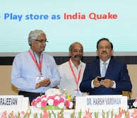
The Union Ministry of Earth Science has launched India Quake application on the occasion of its foundation day. The mobile app has been developed by the National Centre for Seismology (NCS) for automatic dissemination of earthquake parameter (location, time and ..
Month: Current Affairs - July, 2017
The Union Ministry of Earth Sciences (MoES) launches ‘India Quake’ app for dissemination of earthquake parameters
The Union Ministry of Earth Sciences (MoES) has launched two Mobile apps – India Quake and Sagar Vani to send alerts on earthquake parameters and oceanic disturbances. The ‘India Quake’ will automatically disseminate earthquake parameters like location, time and magnitude, ..
Indonesian Earthquake: Dozens dead
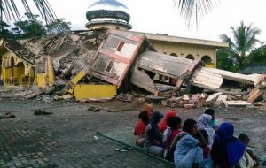
An earthquake of 6.5 magnitude on Richter scale in Sumatra has killed about 92 people and many dozens have been left trapped. Hundreds of people have been injured and many buildings have also collapsed. The earthquake struck at dawn when ..
Japanese scientists detect rare deep-Earth tremor S wave microseism
Scientists in Japan studying earthquakes for the first time have detected a rare deep-Earth tremor, known as an S (secondary) wave microseism. Microseisms are very faint tremors. The detection was made by scientists from the National Research Institute for Earth ..