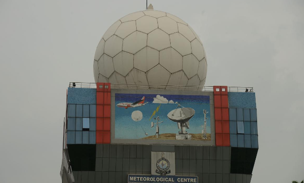
New X-Band Radar Approved for Wayanad Flood Monitoring
In July 2024, devastating floods and landslides hit Wayanad district in Kerala, killing more than 200 people. To prevent future disasters, the Union Ministry of Earth Sciences approved the installation of an X-band radar in the region. This radar will help improve weather tracking and provide early warnings for landslides.
What is Radar and How Does It Work?
Radar, which stands for “radio detection and ranging,” works by sending out radio waves to detect objects and measure how far away they are. A radar system has two main parts: a transmitter that sends signals and a receiver that picks up the signals when they bounce back from an object. By analyzing these returned signals, the radar can figure out important details like the object’s distance and speed.
What is Doppler Radar?
Doppler radar is a type of weather radar that uses the Doppler effect. The Doppler effect happens when sound or light waves change frequency based on whether something is moving toward or away from you. In weather radar, this helps track how fast clouds are moving, which way they’re going, and how heavy the rainfall is by measuring how the signals change when they bounce off moving rain or storm clouds.
What is X-Band Radar?
X-band radar uses radio waves in the 8-12 GHz range of the electromagnetic spectrum. These shorter waves create clearer, high-resolution images but don’t travel as far because the signal weakens more quickly. In Wayanad, the X-band radar will focus on monitoring soil movement to predict landslides and provide fast, accurate environmental data.
India’s Radar Network
India has been using meteorological radars since the 1950s. The first X-band radar was installed in 1970. Now, India has both X-band and S-band radars (which have longer ranges). Under a program called “Mission Mausam,” India plans to install 60 new weather radars by 2026 to improve weather forecasting across the country.
What is the NISAR Project?
NISAR is a joint satellite project between NASA and India’s space agency, ISRO. It will use a special type of radar called synthetic aperture radar to create detailed maps of Earth’s surface. This radar will use both L-band and S-band frequencies to track changes in the land, like deforestation and soil movement. NISAR is expected to launch in 2025.
Month: Current Affairs - October, 2024
Category: States Current Affairs


