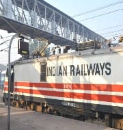
ISRO's GAGAN to provide navigational support to Indian Railways
ISRO has announced to provide navigational support to Indian Railways through GPS Aided Geo Augmented Navigation (GAGAN) system.
The navigational support along with space technology-based tools will be provided to Indian Railways for unmanned level crossings safety.
By using GAGAN software system, a train will get to know the location of any unmanned level crossing by a warning signal. Once this warning signal is given, the train’s hooter will automatically start when it comes near an unmanned crossing.
About GPS Aided Geo Augmented Navigation (GAGAN)
- GAGAN was jointly developed by the ISRO and Airports Authority of India (AAI) for the advancement of air navigation.
- It is an indigenous navigational guide system developed on the lines of GPS system of the US.
- Presently, GAGAN signal is broadcasted through two Geostationary Earth Orbit (GEO) satellites-GSAT8 and GSAT10.
- The system was launched in 2011 as a payload with GSAT-8. With this launch India had joined the club elite nations comprising of US, Europe and Japan who have the same level of space-based augmentation for navigational purpose.
Month: Current Affairs - June, 2015


