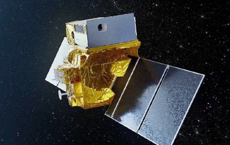
Indian-French TRISHNA Satellite Targets Climate Change Impacts
The Indian Space Research Organization (ISRO) and the French Space Agency (CNES) have agreed to work together on a satellite mission called TRISHNA. This is because rising temperatures around the world mean that environmental monitoring needs to be better. On June 5, which is Environment Day, this new development was brought to people’s attention. It shed light on the satellite’s abilities and how it might help in tracking changes in the environment caused by climate change.
About TRISHNA
The Thermal Infra-Red Imaging Satellite for High-resolution Natural Resource Assessment, or TRISHNA, is a big satellite project whose only goal is to take detailed pictures of the Earth’s surface. TRISHNA is set to be launched in 2026 and will work from a sun-synchronous orbit 761 km above Earth. Its main job will be to keep a close eye on many environmental and climate factors.
Objectives and Goals
The goal of TRISHNA is to simplify the Earth’s energy and water processes by giving accurate measurements of water stress on land, changes in water quality in coastal and inland bodies of water, and evaluations of urban heat islands. As secondary goals, we will look at temperature anomalies, glacier dynamics, and snow-melt runoff, all of which are important for understanding geothermal resources and volcanic activity.
Technological Advancements
The satellite will have two main payloads: a Thermal Infra-Red (TIR) sensor from CNES and a Visible, Near Infra-Red, and Short Wave Infra-Red (VNIR-SWIR) sensor made by ISRO. These high-tech tools will make it easier to map the surface temperature with great detail and analyze the surface reflectance in great detail. Both of these are key to collecting important biological and atmospheric data.
Impact on Environmental Management and Research
The TRISHNA data will help several global projects, including the Global Water Watch, the Sustainable Development Goals of the UN, and the Group on Earth Observations Global Agricultural Monitoring (GEOGLAM). The mission’s results will also be used as Essential Agricultural Variables (EAVs) and Essential Climate Variables (ECVs), which are important for planning how to handle the environment and crops around the world.
Month: Current Affairs - June, 2024
Category: Science & Technology Current Affairs


