
ESA’s Biomass Mission
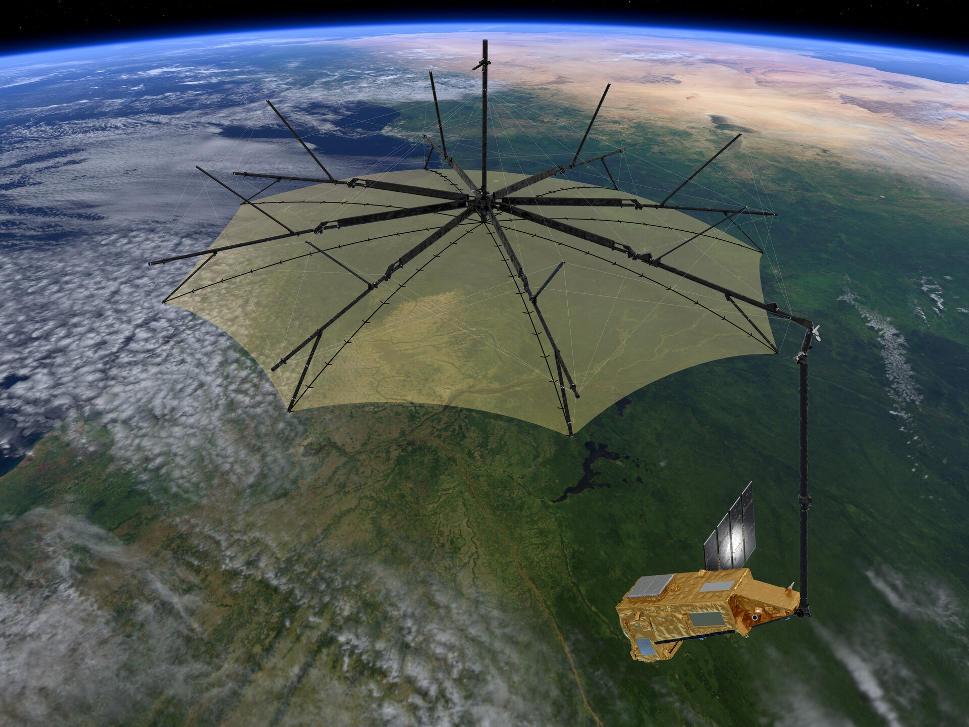
The European Space Agency (ESA) is set to launch its Biomass mission, aimed at mapping the world’s forests. Scheduled for lift-off on April 29, 2025, this mission will enhance our understanding of forests’ roles in the carbon cycle. The satellite will operate in a low Earth orbit, using a synthetic aperture radar (SAR) to assess forest biomass and carbon storage.
Mission Details
The Biomass mission will utilise a single satellite equipped with a P-band synthetic aperture radar. This radar operates at a frequency of 435 MHz, allowing it to penetrate forest canopies. The satellite will provide critical data on forest biomass, carbon storage, and changes over time. It will also generate 3D images of forests during its initial operational year. The mission is designed to last five years, with a focus on interferometric acquisitions to monitor forest changes accurately.
Forest Monitoring
Forests play important role in the global carbon cycle, absorbing approximately 16 billion metric tonnes of CO2 annually. However, there is lack of data on forest biomass and height. The Biomass mission aims to address this gap, providing vital information about the state of forests and their contributions to carbon dynamics.
Environmental Impact
In 2023, an estimated 3.7 million hectares of tropical forests were lost, contributing to around six percent of global CO2 emissions. This alarming trend puts stress on the necessity for accurate forest monitoring. The Biomass mission will enable scientists to measure how carbon levels change due to deforestation and climate change.
Broader Scientific Goals
Beyond forest monitoring, the Biomass mission will also observe ice sheet movements in Antarctica. It will create digital models of terrains covered by dense vegetation, offering vital information about various ecological systems. This data will be invaluable for climate research and environmental management.
Earth Explorer Programme
The Biomass mission is part of ESA’s Earth Explorer programme, which aims to provide essential information about various Earth systems and support climate research and societal needs. They serve as the foundation for operational missions like the Copernicus Sentinel missions.
List of Earth Explorer Missions
- Gravity field and steady-state Ocean Circulation Explorer (GOCE) (2009–2013)
- Focus: Earth’s gravity field and geoid.
- Use: Ocean circulation, Earth’s interior physics, sea level changes.
- Soil Moisture and Ocean Salinity (SMOS) (launched in 2009, still active)
- Focus: Soil moisture & ocean salinity.
- Use: Better weather and climate models, Earth-atmosphere interactions.
- CryoSat (launched in 2010)
- Focus: Ice thickness changes.
- Use: Ice volume monitoring in polar regions, study of climate change effects on ice.
- Swarm (launched in 2013)
- Focus: Earth’s magnetic field.
- Use: Understand Earth’s magnetic dynamics (dynamo), changes in field strength.
- Aeolus (2018–2023)
- Focus: Global wind profiles using laser technology.
- Use: Improved weather forecasting, paved way for Aeolus-2.
- EarthCARE (launched in May 2024)
- Focus: Clouds, aerosols, and Earth’s radiation balance.
- Use: Better climate models and weather forecasts.
- Biomass (upcoming)
- Focus: Forest condition and carbon storage.
- Use: Track forest changes, role in carbon cycle.
- FLEX (upcoming)
- Focus: Plant photosynthesis via fluorescence.
- Use: Understand carbon and water cycles, plant health.
- FORUM (upcoming)
- Focus: Far-infrared radiation (not measured before).
- Use: Improve understanding of Earth’s radiation budget and climate models.
- Harmony (upcoming)
- Focus: High-resolution monitoring of Earth surface motion.
- Use: Data on oceans, ice, earthquakes, and volcanoes for climate and disaster risk research.
Related Posts


Month: Current Affairs - April, 2025
Category: Science & Technology Current Affairs