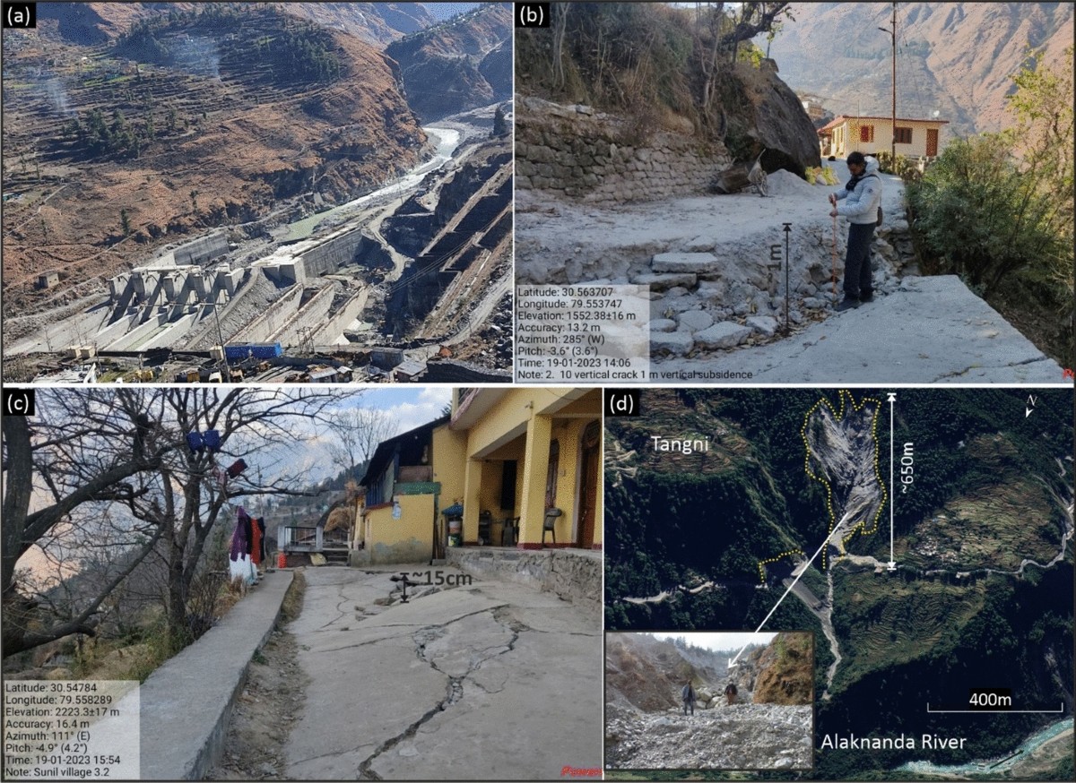
Alaknanda River’s Landslide Vulnerability
Recent studies have brought into light the Alaknanda River’s susceptibility to landslide-induced natural dams. Researchers from IIT Roorkee, Shivani Joshi and Srikrishnan Siva Subramanian, conducted a comprehensive study titled ‘Landslide Dam Studies in Uttarakhand, India – Past, Present, and Future’. Published by Springer, the study identifies the Alaknanda River as the most vulnerable in the Garhwal region. The unique topography of Uttarakhand, characterised by narrow valleys and gorges, contributes to this vulnerability.
What are Landslide Lake Outburst Floods (LLOFs)?
Landslide Lake Outburst Floods occur when a landslide blocks a river or valley, creating a natural dam. This dam impounds water, forming a lake until it eventually breaches. The sudden release of water can lead to catastrophic flooding downstream. Factors such as slope instability, intense rainfall, and seismic activity trigger these landslides. The study indicates that climate change has exacerbated the frequency of landslide dams in the higher Himalayas.
Geographic Impact of Landslide Dams
The study reveals that Chamoli district is the most affected by landslide dams, followed by Rudraprayag and Uttarkashi. All three districts are located within the Garhwal region. The Gohna Tal incident in Chamoli stands out as the most severe landslide damming event. Formed in 1893, Gohna Lake partially breached in 1894 and completely in 1970, impacting areas as far downstream as Haridwar.
Historical Context and Trends
Landslide dam formations in Uttarakhand date back to the Last Glacial Maximum, occurring approximately 29,000 to 19,000 years ago. Significant landslide events have been recorded since the 19th century. The peak month for landslide dam occurrences is August, coinciding with the monsoon rains. Recent decades have seen an increase in disasters linked to these dams, driven by climate change and human activities such as deforestation and road construction.
Challenges in Disaster Management
Despite fewer major incidents since 2018, the unpredictability of dam stability remains a challenge for disaster management. The study emphasises the need for preparedness to mitigate future risks. Heavy rainfall and cloudbursts are key triggers for landslide events, with debris slides being the most common type of landslide causing river blockages in Uttarakhand.
- LLOF – Landslide Lake Outburst Flood, a sudden release of water.
- Gohna Tal – The most severe landslide dam incident in Chamoli.
- LGM – Last Glacial Maximum, for historical landslide formations.
- Chamoli – District most affected by landslide dams in Uttarakhand.
- August – Peak month for landslide dam events due to monsoon rains.
Future Considerations for Uttarakhand
The study marks the growing need for effective disaster management strategies in Uttarakhand. As climate change continues to impact the region, understanding the dynamics of landslide dams is crucial. Enhanced monitoring and preparedness efforts will be vital in safeguarding communities against potential flood risks.
Month: Current Affairs - January, 2025
Category: Environment Current Affairs


