What Is Copernicus EMS Rapid Response Service?
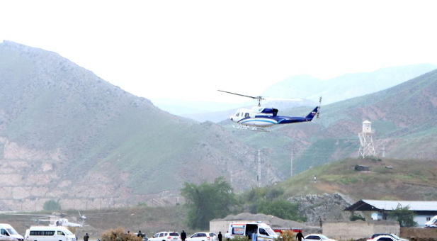
The Iranian President Ebrahim Raisi and other important leaders were in a helicopter that crashed in East Azerbaijan province on May 19, 2024. Search and rescue efforts were made harder by bad weather and darkness, which is why Iran asked the European Union for help.
European Union’s Response
The European Union used its Copernicus Emergency Management Service (EMS) rapid reaction mapping to help with the search after Iran asked them to. The European Commissioner for Crisis Management, Janez Lenarčič, made it clear that this move was only for humanitarian reasons and not for political reasons.
What is Europe’s Copernicus Programme?
Copernicus, which started in 1998 and used to be called the Global Monitoring for Environment and Security Programme (GMES), uses data from satellites and other sources to give people around the world information about safety and the environment. This EU space program helps with disaster management, climate tracking, farming, and other important areas.
The Copernicus System and its Components
Copernicus uses a network of satellites called the Sentinels, as well as monitors on the ground, in the air, and at sea. The information gathered is very important for the European Space Agency (ESA), the European Environment Agency (EEA), and other groups running the program. It is free and open for everyone to view.
Functionality of Rapid Mapping
When turned on, the Copernicus EMS’s fast mapping quickly turns satellite images and data into detailed geospatial data. It gives first impressions and then more in-depth studies of the affected areas, which is very helpful for handling and responding to emergencies.
More About Copernicus Emergency Management Service
- Overview of CEMS: The Copernicus Emergency Management Service (CEMS) is a service run by the EU. In case of an emergency, it can quickly map the area. CEMS was started in 2012 and gives important location information after natural disasters, man-made emergencies, and humanitarian crises. Satellite and in-situ data are used by the service.
- Phases of Emergency Management: CEMS helps with all parts of disaster management, like planning ahead, responding, recovering, and preventing problems. It gives important information for plans to adjust to climate change.
- Specialized Monitoring Services: CEMS is very important for keeping an eye on forest fires and floods. Things like the European Forest Fire Information System (EFFIS) and the European Flood Awareness System (EFAS) are available through it. These systems give reviews in real-time and after an event to lessen the effects and help resources be used more efficiently.
Month: Current Affairs - May, 2024
Category: International / World Current Affairs • Science & Technology Current Affairs


